flood protection - h÷rdt rhine floodplain
| Relief model | |
| Structure | |
| Topics | |
| Design maps | |
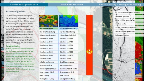
The multitude of historical maps and partly technical maps showing gradual topographic changes were the trigger to think about an interactive map comparison platform. The two illustrations below show on the one hand the navigation layer on the touch screen (below) and on the other hand the display state with two maps on the relief (above).
On the screen the split screen is equipped with a slider so the seam can be moved smoothly between the two maps.
In addition to the existing map material, copies of the projection image can be copied digitally at any time. A symbol (eye) indicates that the option is active. These special maps can also be included on this platform.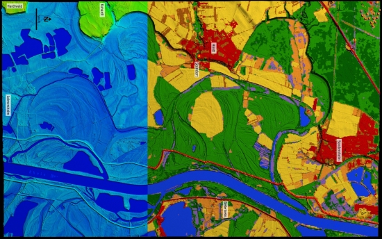
|
above: Symbol display "map copying active" left: bottom left: |