flood protection - h÷rdt rhine floodplain
| Relief model | |
| Structure | |
| Topics | |
| Design maps | |
The Rhine floodplain, which is largely flat for the visitor, reveals amazing details of the river's history when the digital elevation model has vertically been exaggerated.
As long as the Rhine was able to develop freely before the great river straightening by Tulla (19th century) and the taming by dikes, these areas were a jungle-like forested landscape with countless natural water arms, which were actively meandered by the Rhine. In between, stagnant oxbow lakes with bog-like siltation zones.
These areas near the river were clearly set off from the prominent terrace in the western part of the model, where all settlements are located on flood-proof ground, including the village of H÷rdt (see below).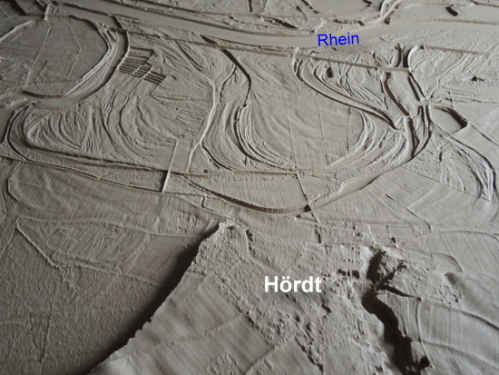
|
above: Detail view of meander arch NE of Kuhardt. left:
© Data base SGD S³d |