municipal drainage department - cologne
| 3D relief modeling | |
| Data preparation for flood simulation | |
| Interaction | |
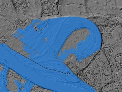
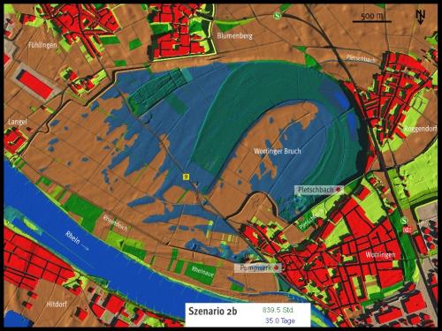
The five flooding scenarios were based on time-dependent water surface calculations provided by water engineers. Up to 2000 flood area calculations per scenario were available in half-hour and daily intervals, which were to be linked to the digital elevation model in a 3D simulation.
|
top: 3D flood situation at dike boundary Motifs on the left: above: Georeferenced flooding overlay bottom: 3D flooding view with objects |