maritime museum flensburg
| Digital elevation model | ||
| Flooding | ||
The scale of the terrain representation determines the visibility of spatial changes, here of the sea level. Thus, one has to absorb the initial disillusionment when viewing the historical flood event in the 3D model.
What caused considerable damage locally on the coasts, especially in the densely populated harbor area of Flensburg, appears rather seemingly harmless in the global view of the entire Flensburg Fjord.
If the rising or falling sea level changes exceed magnitudes of a few meters, however, the all-devouring force of the water is unmistakable. The relatively flat landscape, for example, is then quickly flooded completely when sea level rises sharply and is eventually absorbed into the Baltic and North Seas. Only small islands could then survive.
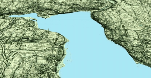
Digital oblique view of the Flensburg Fjord
with view to the west to the Flensburg harbor
Simulation of the hypothetical sea level rise in case,
that all ice masses at the poles should melt.
Plus 66 m !
|
top: Detail of a topographic map showing the deep relief of Flensburg harbor. |