maritime museum flensburg
| Digital elevation model | ||
| Flooding | ||
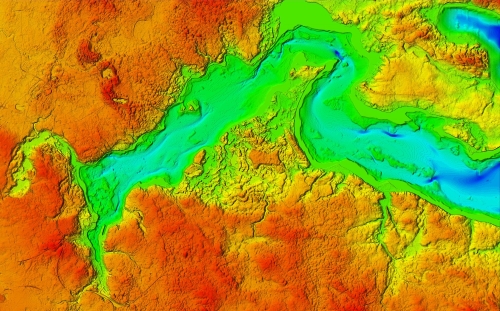
Due to the cross-border terrain section covering large parts of the Flensburg Fjord, obtaining consistent data was a special challenge, especially for the digital elevation model. On top there was the desire to add data below sea level.
All tasks were accomplished with good cooperation from the participating German state and local municipal institutions. Furthermore high-resolution data could be obtained from the Danish side without complications via a website within the framework of the country's typical liberal data policy. Finally bathymetric data were also easily available via the European platform EMODnet (European Marine Observation and Data Network).
|
top: Interesting dune structures at the root of the Holnis peninsula near Glücksburg Castle, which are not easily perceived as expressive in the field. However, the digital model is shown here 5 times exaggerated. left:
Source of bathymetric data: EMODnet |