| |||
 | |||
|
Dear client, |
|||
|
physical landscape models are usually based on real elevation data collected by satellite measurements. They reflect the morphological features of the earth's surface very precisely. However, in certain contexts one would like have more freedom in design and would instead create fictional landscapes that are better suitable for example for the simulation and animation of geological processes. The current project "Tropical Paradise Lausitz? - Climate Change in Tertiary" in a special exhibition at the Museum of Western Lausitz in Kamenz offered this opportunity.
Sea-Level !? The familiar landscapes of coastal regimes change barely in human time scales. Discussions in the context of climate change indicate future developments that, however, correct this static picture markedly. Even more geological observations reveal dramatic sequences of rising and falling relative sea-level, circumstances in which even entire continents were flooded or fell dry again. These complex issues should be made imaginable to layman in an animated form by an interactive landscape model .
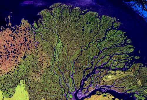
Delta complex Lena, Northern Siberia (© NASA)
Digital 3D-Modeling of Terrains The 3D-modeling of digital terrains is a powerful tool to manipulate existing landscape data or to create entirely new landscapes. Initially, for example, the CNC manufactured relief model based on real elevation data of the Elbe estuary region, which were later changed to such an extent that a classical delta complex is formed. For further smooth animation of geological processes many more sets of different landscapes had to be developed. All of which are used for vertical projection onto the physical terrain model. However, note that all fictional digital data sets would principally also fulfill all requirements to be machine milled (CNC) into solid terrain models. This offers a wide scope of totally new applications.
Digitally modeled landforms in 3D: valley, delta, eroded surface, delta
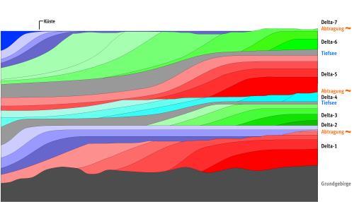
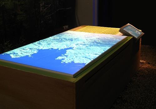
Interaction : Simulation The main aspect of the current project was to provide some insight into the interaction between land and sea and its responsible causes in a playful way. For this purpose the users are successively introduced to the complex matter and can by trial and error or by forward-backward developments get a feel for the factual context. A relatively simple experiment allows making the sea level rise and fall - a short video you may find here. How complicated interactions of land and sea can be, is shown with an "experimental station", where different parameters can be set. The resulting changes to the landscape are projected on the relief model as a flowing development - a short video can be found here. The ultimate discipline is finally a complete geological history that takes place synchronously in the geological cross section and as a fully animated projection on the physical relief model.
„A History”, fully developed geological cross section
View of installation
Conclusion Particularly geologic and geographic aspects can be animated in a very impressive manner using digitally 3D-modeled terrains. Furthermore the resulting database developed from 3D data can also be used directly at the CNC fabrication of physical relief models.
This project is also presented on our website here (in German only). A similar project in 2011 for the Siebengebirgsmuseum in Königswinter you can find here (in German only).
Please consult also our website and check out the range of project solutions, an overview of which you may find in the "projects" section. Please note that the German side of the website gives a more comprehensive and up-to-date insight for the time being.
Thank you very much for your interest! With best regards
Thomas Krüger QUOMODO.de |
 | ||
© 2012 QUOMODO.de, Thomas Krüger, Bismarck 39, 72764 Reutlingen, Germany


